Wednesday, July 6, 2011

Weather, the USA and the Auto Pilot (with a little gin)

Whether the weather! Once it matters, seems the winds blow wrong or the waves threaten. 

Silvery Sunset off Highborne Cay


Sailing back up the Exuma chain we started to notice more and more rain and higher wind than we'd seen for our entire trip. Seems those tropical waves down south are affecting Bahamas' weather too. Where are those "351+ days of sunshine?" On top of off and on drizzle, the RayMarine Auto Pilot was acting odd. It wouldn't correct when a wave pushed the boat too far to port. We tried cutting down the motor, then we tried just sailing. "Does it seem to be working a little better?" Not sure... But we finally made Highborne Cay (anchorage this time). That tropical wave was going in to the Yucatan and we needed to wait a couple of days before sailing over Yellow and Middle Bank on our way to Nassau.

Feeding the Seagulls can be entertaining
Perfect time to polish the stainless steel on deck and clean up the lifelines.

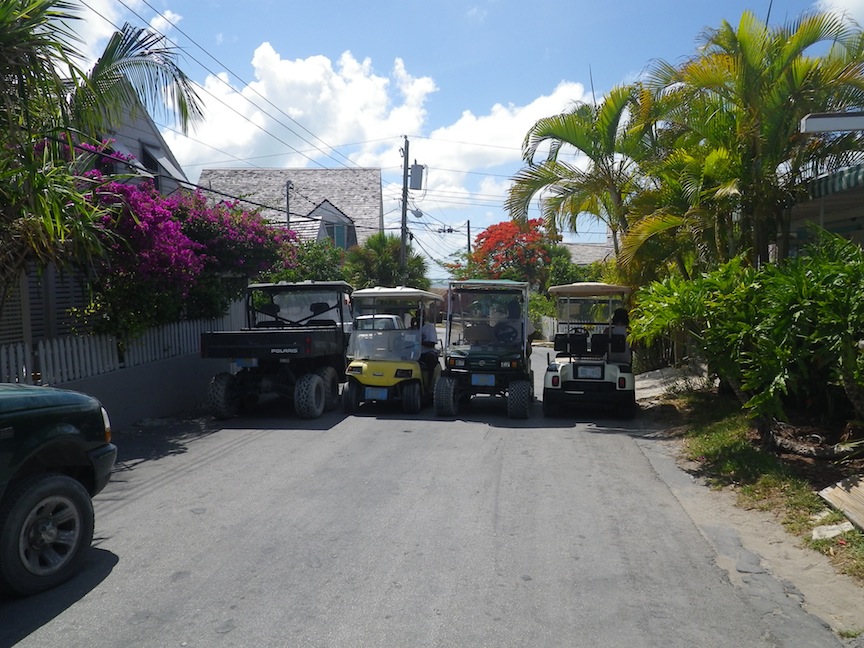
Friday, July 1, looked about right so we headed over to Nassau. Nassau is the capital of the Bahamas and about 2/3 (250,000) of the population live there.

Atlantis
Nassau is the principal city on New Providence Island and occupies most of the eastern half. Right across the harbor is Paradise Island now totally developed for tourism and world renown for the Atlantis Hotel complex. Nearby Rose Island is the gleam in the developers eye.


Sailing to Nassau was a southwest downwind sail of 38.9 nm. Our thoughts centered on whether we could get the AutoPilot fixed there. Somehow the fact of a holiday weekend completely slipped our minds. Nassau was great. Next time we'll arrange to stay longer. We spent the day walking down to Bay St. where the cruise boats come in.


We walked past lots of old colonial architecture and saw loads of upscale shops but ended up, true to form, in the dives on Potters Cay.


Fresh Conch Anyone?
Potters Cay Stalls
Potters Cay is a small island that's now connected to Nassau by a causeway. the causeway is filled with stalls that hang over the water and sell fresh conch and snapper, fruits and vegetables - whatever's in season.
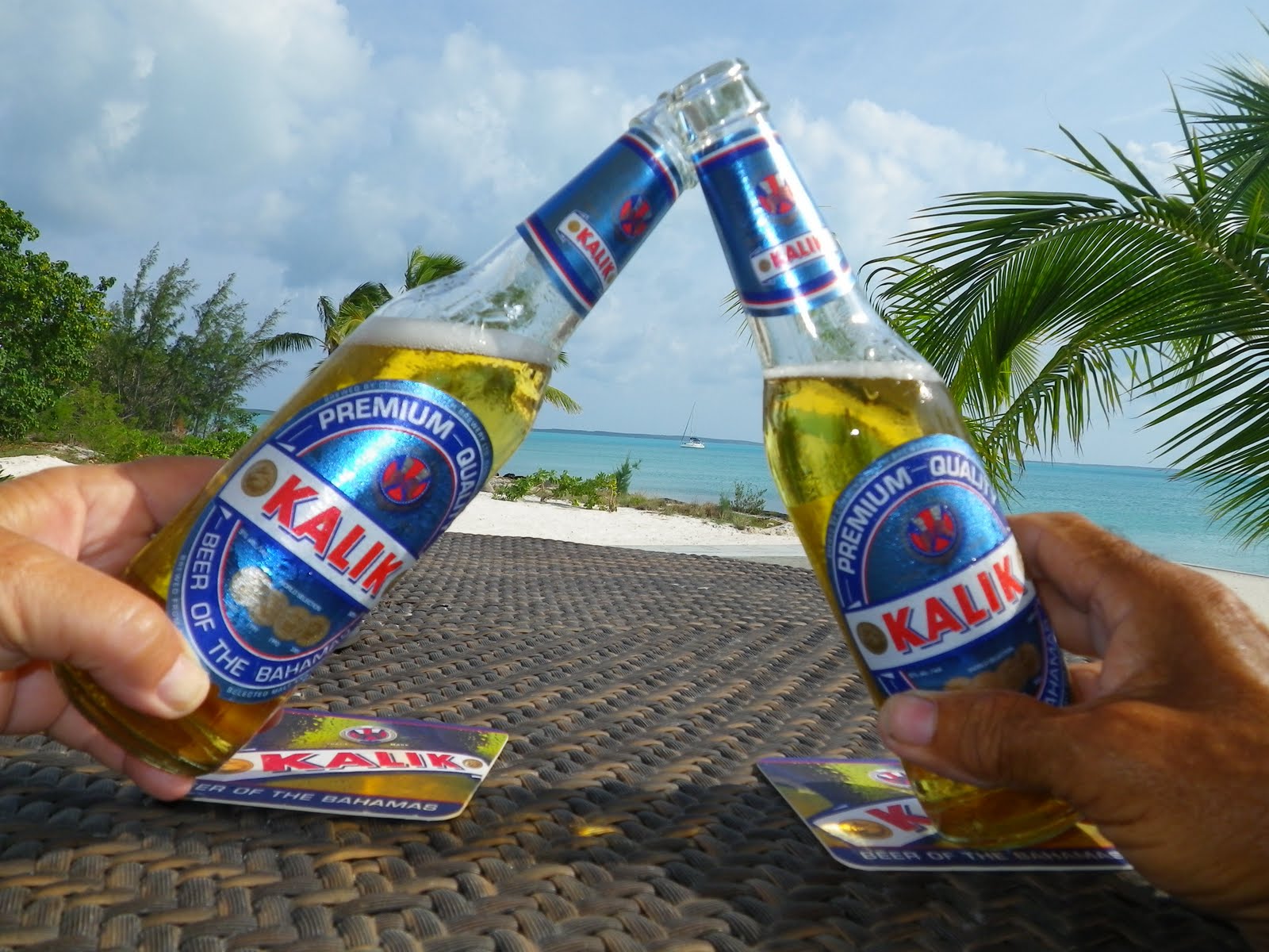
Having that last Kalik


Wanted to leave early on the morning of July 3rd but a persistent drizzle kept us snug in our berth until 6:30am. Whoa! Time to get moving - while untying and getting the boat out of the marina a long splinter lodged itself under Roy's finger, ouch!

Conch Boat's A' Comin
Motored through busy Nassau harbor then set the sails to cross (I love to say this) "tongue of the ocean".  This is where the Atlantic curves south between New Providence to the East and Andros, the largest Bahama Island, to the West and the tiny strip of islands called The Berrys to the north. We were headed to Frazers Hog Cay in the Berry's. For years boats traveling the Great Bahama Bank between Bimini and either Nassau or the Exumas stopped at the southernmost cay in the Berry's, Chub Cay. It was small, handy and had all the right ingredients like fuel, water, a bar and most of all a safe harbor to wait out fronts before moving on. Now Chub is a private development and you can't even get fuel there. The cruising guide recommended the adjoining cay called Frazers' Hog where everything except an all weather harbor awaited. Ha!

It should have been fine for just hanging out but we were told by another boat that everything was shut down. So we looked at the charts, looked at the weather forecast, looked at each other and shrugged. Lets go to Bimini - 80 miles across the Great Bahama Bank where unlit freighters ply the waters and coral heads abound. We needed a challenge; the last week has been too calm. We grabbed an hour of sleep and headed out wanting to past Northwest Light, the entrance to the banks, before full dark.

Small freighter moving lumber
The Great Bahama Bank is a very significant sea scape. Its sheer size is a concern for every mariner. It is 50 nm at its widest part and 180 nm north to south. It is a large shallow shelf averaging about 15 feet deep. it's shifting sandbars are always changing making it impossible to accurately chart. Most of the routes take cruisers across 75 miles of bank so that slower boats like sail boats and trawlers have to figure their best options as they can't completely cross in available daylight hours. We solved that problem by crossing at night.

We kept a sharp lookout all night for those unlit freighters and nary saw a one. Saw other boats off in the distance making other night time crossings to other destinations. Even had a few on the same route as us but generally it was a fine nighttime crossing. Granted our least favorite kind but we were in Hemingway land by 7am.
Bimini- the blue water Grand Isle

Hemingway and Bimini are as intertwined as Hemingway and Key West. On the first trip he attempted, Hemingway tells of catching a large bull shark before even reaching the islands. After finally wrestling it into the boat he tried to quiet its thrashing with his Colt revolver "by shooting himself through both legs with one hand while gaffing a shark with the other. This is as far as this reporter will go to please his readers." (Hemingway, Esquire Magazine, 1935). He returned over and over; set "Islands in the Stream" in Bimini and worked on the manuscript "To Have and Have Not" while there. He also wrote numerous magazine articles including "On the Blue Water", an account of fishing big game fish from small boats far out to sea. The article starkly shows his passion for what was to became the sport of deep-sea fishing.

Bimini Blue Water Marina
Hemingway is a pioneer of the more aggressive way this sport is practiced today. Prior to that time no one went out looking for big game fish or attempted to land them using rod and reel. In fact he was the first angler to land a giant tuna in one piece by rod and reel. He, John Dos Passos and other friends started the Bahamas Marlin and Fishing Club which was the fore-runner of todays IGFA, International Game Fishing Association.

At the Clinic
We didn't have much time but we did stay at the Bimini Blue Water Marina, which is where Hemingway kept Pilar, his boat. Sadly instead of hanging out at the "Compleat Angler" or the "End of the World Bar" we spent our time walking the only street in town down to the clinic to get Roy's finger seen to. What an experience! Almost worth the splinter. We walked about 1 1/2 miles down the single street and turned into the clinic. Roy was given one piece of paper to fill out with his name and the name of the boat. Then he was escorted over to have his vitals taken by a nice nurse from the Philippines. Next came the  doctor who deadened his finger to cut out the 3/4 inch long splinter, bandaged it, gave him a tetanus shot, antibiotics and motrin for pain. How much time? About an hour. And the cost, you ask? $105.00 please!

One of the most amusing things was to hear Roy called Mr Wal-ter, in that lovely singsong West Indian accent. Made us think of the original Mr. Wal-ter and Belize.

The next morning it was crossing the Gulf Stream and on to Miami.

Of course, you probably guessed, the Auto Pilot went completely bonkers and Roy had to hand steer all the way. This was not a good day for the 6 ft waves that built up by the time we were fully in the stream. Boy were we glad to get in to "No Name Harbor" on Key Biscayne. Slept like we were dead.

Today we checked in with Customs and Immigration and Roy spent the afternoon wrestling the Auto Pilot out of the hole. Tomorrow we package it and send it off. They say a week or so.

Going down
2 hours later


Oh well, we've always wanted to visit Miami.
Here's a PS for all our gin loving friends:
We found a new gin in the Bahamas - New Amsterdam gin
The bottle is the color of that very light green almost white water where you say "over to port, OVER TO PORT!, OH SH##*! 
We're calling it running aground green.

So if you're keeping track we now have
1. Running Aground Green for water 0-3ft
2. Bombey Blue for that perfect water 5 - 12 ft over sand
3. Tanqueray Green for that 10 - 15 feet that's crystal clear and over grass
4. Sky vodka for that deep blue ocean that's 1000 - 2000ft (couldn't find a gin)

Friday, July 1, 2011

Cruising the Exuma Chain

Seen from the dingy in 5 ft of water
Ah, the Exumas. Finally, on June 11th - after 4 days, the rain stopped, the sun shone and we sailed to the Exuma Chain. The cays of the Exumas are the mecca for the cruising crowd. Starting with Allen Cay and its Iguanas all the way down to Georgetown, where cruisers wait to finally head South to the “real Caribbean.” The Exumas are a chain of islands 80 miles long. They lie about 40 miles southwest of the Eleuthera chain, our last sailing ground.


Conch Nursery - taken in about 2 ft of water
Much of our way along the Exumas was dictated by our need to stay in touch with Renee and monitor( help if possible) Austin’s progress. So glad to say that he’s doing better. 

Can you spot it?
The Exumas are more remote and less inhabited than the Abacos and the Eleutheras. Nearly one third is taken up by the Exuma Land and Sea Park. The Park is 176 sq miles, 22 miles long. As we were going to stop going South at Staniel Cay, 40 miles from Georgetown, the end of the Exuma Chain, they were a large part of our visit. In Exuma Park there is no phone service and not much internet service, definitely no Skype. At Staniel Cay and Pipe Creek Alley, all south of the park, internet is metered at $10. per day for 100 – 200 MB depending on where you are. Whatever internet is there is satellite based and very, very sloooooowwwwwww. Often, even if you’d paid, the service was down. Phone service, except at Highborne Cay, to the north, and Staniel Cay, to the south was non-existent to iffy. I don’t think most people who come to the Exumas need to stay in touch. Next time! 
Wahoo at anchor - Warderick  Wells (Park Headquarters)

 The Park has many of the most beautiful reefs you will see in the Bahamas. As it’s a “no take zone” it’s conch, lobster and other fish act as a nursery for the aquatic life throughout the southern Bahamas. 

Coral Gardens
Our first “land ho” after crossing Exuma Sound was Highborne Cay. We reached it by sailing from Rock Sound Eleuthera across Exuma Sound where our depth sounder once again just read “Deep”. Exuma Sound is basically part of the Atlantic with a few cays to break up the swells rolling in from Africa. We decided to treat ourselves to a “marina night”. Highborne Cay Marina is a wonderful facility with a fuel dock, water metered at .50/gal (as we saw throughout the Exumas) a great beach, wonderful snorkeling spots, nurse sharks and sting rays to watch. It has someone to wash your clothes, power & water hookups, $10 internet (200 mb) and a small grocery and gift shop. But you know, we were the only sailboat there! Everyone else was either a trawler or a fishing boat – sailboat people don’t waste money in “stinking marinas.”  
On the Reef

So our 2nd night we anchored on the “bank” side of Norman Cay. You see the Exumas run southeast with the deep Exuma Sound to their East and the shallower, coral-head filled Exuma Bank to their West. So you can access the cays from either side switching back and forth through the cuts as wind and weather and your inclination dictates. Exuma Sound = deeper water and fairly straight sails to your next port. Exuma Bank = shallow water, gentler winds and seas, mostly motoring and lots of VPR(visual piloting rules).


Norman Cay is famous for two things: 
Today:
 Mcduffs beachside hamburger joint. 
Boats line up and radio ahead for reservations 
  We spent a couple of days there as the phone service was pretty decent, the hamburgers were great, as was the snorkeling and conch “diving”. Also we made friends with Rhett and Emily, previously from Shreveport, who had shown up about a week before us and now were the bartender and waitress at McDuffs. 

We "salvaged" these at Norman's Cay

Plane barely showing at high tide


Yesteryear: It was the headquarters of Columbian drug lord Carlos Ledner. The cay still hosts the drug compound with an impressive deepwater dock, an airstrip now in use by small planes and most fun of all – a wrecked drug running plane in about 5 feet of water.


Left Norman Cay with plans to spend a few days near the Park headquarters, Warderick Wells Cay. This cay actually has a fresh water lense beneath the rock – hence its name.
The protected harbor outside of Park headquarters is one of the loveliest you will see with all the boats riding on mooring balls in a crescent of Sapphire, Turquoise and Deep Blue Water.
Mooring Balls in front of Park Headquarters - Wahoo center of picture

Ended up staying only one night due to lack of phone service. But that was just find as our next anchorage proved to be one of our favorite spots, Pipe Creek Alley. This is a narrow channel that winds its way between several cays. If you’re careful not to run aground it’s just lovely and filled with great coral gardens for drift snorkeling, sweet little beaches and mangrove creeks for exploring. It was here we met up with two boats traveling together, old hands at visiting and exploring the Bahamas. Don and Barbara on their sailboat “Checkmate” have been coming for 30 years. Lee and Carol on their trawler “Our Destiny” have been visiting for 10.
Queen Angelfish

I’d hate to think where we’d be without Lee. On our 1st morning at anchor in Pipe Creek Alley he woke us up to deliver our wayward dingy (and new outboard motor!). Seems the bow line and dingy had decided to part company while we slept. Luckily Don was awake and enjoying his Wheaties when they did the dastardly deed


Trumpetfish - looks like part of the coral


Nurse sharks can always tell suppertime
No way to thank anyone enough for that except by inviting them for cocktails! They gave us so many, many good pointers. Of course the invitation was returned and we went to their boat.  For several days we met up for some great cave dives and snorkeling trips off of Cambrige Cay in the southern end of the park. AND near the island owned by Johnny Depp.


Arrival Staniel Cay Bahamas
Swimming out to meet our boat

The end of the Exuma chain for us was Staniel Cay and the culmination was Sammye and Grouper’s visit.We swam with the freckled, carrot loving, Bahamian pigs; explored Staniel Cay village – all 3 blocks; Ate and drank at the Staniel Cay Yacht Club (finally a bar!); explored Thunderball Cave ( yes the 007 movie “Thunderball” was filmed there) swam and snorkled our hearts out then were invited to a cochon d’lait on the beach for the “big boats”. These are the famous Bahamian sailing sloops – Staniel Cay sailors win the regattas nearly every year and throw a party to celebrate!

They love carrots
Fun, at least until it was time to come home. As we were dingying our way back to Wahoo, WITH navigation lights on and a lookout, a small skiff, SANS lights or lookout, rammed us. Thanks to Sammye’s alerting yell, Roy managed to swing the boat a little - enough to avoid a much worse head-on collision with even more damage. As it was, Grouper took the full brunt of the blow and had the wind knocked out of him, plus serious bruises followed by serious pain. He’s doing better now. But it made for a quiet time on their last day with us. Yet we managed to fill it up with steamed lobster, conch fritters and “Capt Ron”.  


Snorkeling the caves was an quite and experience. We were happy to have Lee to show us the way during our first cave dives at Rocky Dundas. But the most impressive was Thunderball Grotto near Staniel Cay.
Lee and Dale at Rocky Dundas


Thunderball Grotto

Entrance to Thunderball 

Roy and I have now turned the boat to run up the Exuma Chain starting our journey back to New Orleans. We should be in Nassau in a few days. (Well we’re probably there now as I can’t send this until we are)


Thursday, June 9, 2011

In the Eleutheras

Andrew at the Helm
Fishing Boats in Spanish Wells
This archipelago is east of NewProvidence (Nassau) and south of Abaco. It consists of many small cays on the north then one very long (90 mile) very narrow (3 miles) island extending south.


In the north is Spanish Wells, named for the Spanish Galleons that attempted to land here and get fresh water. Mostly, they ended up on the reef of "Devil's Backbone". Lovely Harbor Island is just a water taxi, land taxi and another water taxi away. Actually the whole thing only takes about 30 minutes but you do get on and off alot!
Car Transport in Spanish Wells

Stretching south we hit Governor's Harbor which is about midway down the island and lastly we are spending, a bit too much, time in Rock Sound. The island seems very different from the other Bahamian Islands we've visited. Its sand is much more pink, it's actually hilly - highest point in the Bahamas at 100+ ft and its people seem much more industrious, though just as nice. There's also at least one church per person and bars and liquor stores are hard to find, but we managed.
We Do Laundry

Spanish Wells felt like a shift change as Andrew bid us adieu and Mary arrived. Spanish Wells also felt like Lafitte with its fleet of fishing boats and shipyards. 50% of all Bahamaian seafood comes through Spanish Wells and 70% of the crayfish (spiny lobster).

We did indeed get over to Harbor Island for a day of swimming in the Atlantic, cruising the shops and sightseeing. Sally Miles, Mary's older sister used to live here so Mary knew it well.
A pretty girl could block the street in Harbor Island


Sally joined us in Govenor's Harbor and we spent several great days touring the rest of the island. The narrowest part of the island is called the Glass Window and once had a natural bridge. Through that gap the deep blue waters of the Atlantic and the turquoise waters of the Bahama banks meet!! A "rage" blew out the natural bridge, which was replaced by a man made bridge. Then another, more recent rage, actually shifted the bridge 7 feet!

There are great caves to explore and this amazing gorge named the Queen's Bath. This is also the only place, other then Belize, that we've seen "blue holes"!


Mary gathered trash, we goofed off


The Glass Window where the Atlantic and Bahama Bank waters meet


Queen's Bath


Approaching Current Cut
The sail from Spanish Wells to Govenor's Harbor on Friday, June 3, was exciting. First we had to go through Current Cut, a narrow opening between two islands, where the current is extremely high and your boat must turn to starboard as you pass through the cut or you will end up on the shoals. Whew!!!  Then as we turned Southeast, the waves picked up and the boat was plowing through them, often waves covered the bow of the boat. It took us twice as long as normal to cover the 30 miles to safe harbor and all the while we were under a bright blue sky sailing through crystal clear blue waters. The worse outcome was that we neglected to dog down the porthole over our new long distance WiFi connector and it was drenched in seawater making it inoperable. 
Sign says it all


Fighting for Conch Fritters at the Pineapple Festival
Bob at Island Time came through and he helped Roy figure out a work around. So hooray - WiFi is back (as long as we can find a connection, of course). We finally got all the connections correct so anyone who has emailed between Monday and now will start getting answers. Also remember if you see an unknown number on your phone - could be us not just the bill collector. With WiFi comes Skype.


 Of course, we didn't let lack of WiFi or lack of water slow us down. Oh, I didn't tell you about the water. We were out and had no idea that Friday, June 3 was a holiday and everything would be closed. Plan A which was getting water before we left Spanish Wells was thwarted. Plan B depended on our trusty guide book. It said that while anchoring in Governor's Harbor was a chore - grass and thin sand over rock, we would find a seawall where we could tie up and get water if we had our own hoses. Ha!!

Adding Water
Lucky for us sailboats at the seawall are a rarity so we became an instant attraction. Nice folks let us have about 20 gals which we carried in 1/2 gal bottles and a jerry jug. Later Mary & I waved down a water delivery van and bought 20 more gallons in 5 gal jars.

Not wanting to let water or WiFi get us down we took off to find a bar, remember - there were no bars in Spanish Wells. Walked into Ronnie's and sat next to this big guy and started talking. Pretty soon he gets the "out of water" story and offers to take us up the road to a restaurant owned by Lionel. Lionel is also the dock master and eventually got the pump turned on, a faucet going and extra hoses to help reach it. Turns out the guy we were sitting next to is famous. He's Doctor Seabreeze - singer and songwriter in these parts!

Having dinner and singing along with Dr Seabreeze


This is Preacher's Cave. The first European Settlers of Eleuthera shipwrecked on Devil's Backbone and lived in this cave for two years. There is a plaque in front saying that this is where the first "Christian Communion Service was held in Eleuthera". Pretty important for an island with so many churches and so few bars!


Natural Vent Holes Inside Preacher's Cave


Now Mary and Sally have gone and Roy & I are waiting to head to the Exumas. In the meantime we've just discovered Four Points Restaurant, best food off the boat so far and a young chef that reminds us of Mat,t if Matt had been Bahamian - ok, not so sure we want to leave afterall. 

See Wahoo at anchor in the distance