Monday, June 25, 2012

Hasta La Vista Mexico; Hello Belize

We did It!! Yeah, we are anchored behind the reef outside of San Pedro on Ambergris Caye.


The narrow pass out of Puerto Aventuras
We "passed a good time" in Puerto Aventuras but like all good things it had to end. Once we felt it was time to move on we visited Geraldo, the Puerto Aventuras dockmaster, to get the scoop on checking out of Mexico.  Option 1; take a bus, then a ferry then hire a taxi to drive us around Cozumel to visit immigration, customs and the port captain in order to pay for the Zarpe (exit papers) and get our passports stamped. Option 2, we could pay for an agent to make the trip to the marina. He would then do all that running around and bring everything back to us. Not able to tell which would cost more we opted for the easier route and asked that he come to us. Like a bad Central American movie we met in a dimly lit bar and handed over money and passports. Actually, it worked fine and the next day we were all cleared out and ready to travel. Though, we were $200US poorer.

But... yep, there's that but. This was the day that what became Debby appeared over the Yucatan. Had us making up new lyrics to Hotel California.

"Next thing I remembered we were headed for the reef
Had to find the way back out to the sea we left before
But Halt said Geraldo the red flag's in place
You can check out anytime you like
But its not safe to leave."

Eventually the rain and wind slacked off and hopes for better weather entered the forecast. At 6pm on Thursday, June 21st we headed out through the narrow pass that leads from Puerto Aventuras Marina to the Caribbean Sea. Turned South and we were on our way to Belize, with four carefully mapped out anchorages to make for a delightful trip. A 10 kt South wind and a 3 kt northward current didn't make for swift sailing but at least the waves were only 4 ft and they were from the East, from all those days of East winds. As soon as the wind moved a little East of South we raised both the jib and the main and sailed close hauled. The only disappointment was passing Tulum at night. As the gloomy evening settled into a dark rainy night we closed up the cockpit and let our Raymarine chart plotter work its magic. After setting the course the autopilot and the chart plotter kept us on track. The radar screen became our eyes and the depth finder provided the comfort of knowing we were in deep waters with no shoals. Considering all that, we actually made excellent time and passed our first possible anchorage about 4 am. Knowing we couldn't attempt to go through a reef opening in the dark we sailed on to our 2nd anchorage. Arrived there about 10am and found a wide passage through the reef to a roly but secure spot, dropped the anchor, had a little lunch, watched a movie, went to sleep. Next morning, time to go, started the engine, turned on the instruments. That new, wonderful Raymarine chart plotter had died overnight! Roy and Sebastien tried everything, I even read the manual!! Nothing.

What to do? What to do?  We have a backup GPS/Chart Plotter program, in fact we have two; one on the computer and one on the Ipad. All our course planning is done on the computer so that meant all our waypoints down the coast were available. However, that would not provide radar or depth. We had no backup for that. 

Perfect!
Roy felt he could get us back out through the reef (remember that wide opening) to the sea so we decided to continue South, stay where it was deep, not make another anchorage, and sail the 108 nm straight to Belize. We would figure out how to get through the reef when we got there. It was a beautiful day to sail, the first blue sky we'd seen in over a week. Seas were just some 4 -5 ft swells, the winds were SSE and we were watching for that elusive sailor's dream, a beam reach. It was that kind of day, the kind that makes you know why you go out on the sea in a small ship. 


All days end, and at the end of this one, 
in the dark, we started seeing lightning over the mainland. Without radar we couldn't tell how the storm was moving. We watched the night hours wear slowly away. Then shortly after Sebastien came on the helm at 1am he saw the wind go from 15 to 23 kts in a matter of seconds. He woke Roy and rushed to get in the mainsail, we had taken in the jib earlier. He fought to get the last of the sail down as Roy held the boat into the wind which had risen to 55 kts (62 m/hr). However, heading into the wind meant heading towards the coast and the reefs! I was watching the computer's chart plotter for whatever depth information I could give him. Fortune smiled and the storm only lasted about 1 1/2 hours. The winds started to die down and Roy could safely turn the boat away from the coast and back towards our southerly course. We sailed through what was left of the night and were relieved to see daylight come.

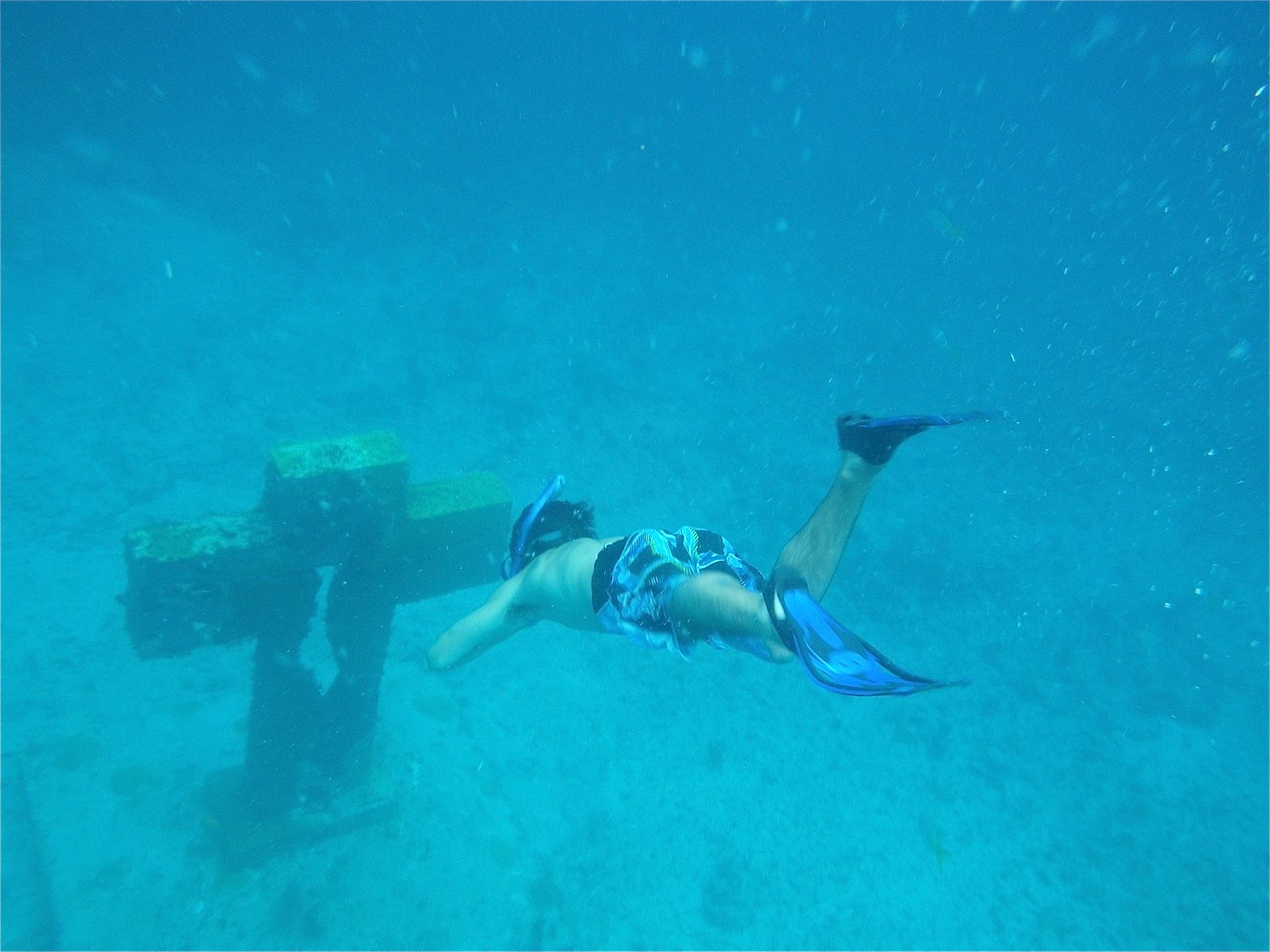
Being guided through San Pedro Pass
By 9am we were outside of the reef which runs along the Belizean coast and now faced trying to get through the San Pedro Pass. The answer turned out so simple, glad we hadn't worried all night about this. We hailed a tour boat on its way to Turneff  Atoll. They called a local dive shop that sent a boat to guide us in. Welcome to Belize!


New Friends and a Celebratory Dinner - what's not to love

Puerto Aventuras to San Pedro Pass 188.61NM 

Entrance to Bahia del Espiritu Santo is through a very wide pass with Fupar Reef to the north and Naja Reef to the south. You have to look for the reefs' breaking water to see them.
Approach to Fupar Pass  19 23.23N  87 21.39W
Fupar Pass 19 22.77N  87 26.39W
Anchorage  19 22.65N  87 27.99W
Freya gives 2 other anchorages, one behind each of the reefs but we had settled weather and choose not to go any farther. Above waypoint is where we dropped the anchor.

San Pedro Pass Approach from the Caribbean 17 54.23N  87 56.99W
San Pedro Pass 17 54.36N  87 57.56W  
In 2012 there was a Yellow Can marking the pass. Keep a bow watch as you must steer to starboard to avoid a coral head once in the pass. Do Not Attempt in rough seas. In light wind even on a cloudy day you can see the pass and the reef. Once inside the reef continue to starboard and drop anchor. We anchored between Ramon's and Hurricane's Bar. Stay near your boat when swimming. Better yet dingy to the reef.

Sunday, June 17, 2012

More Adventures in Mexico


Leaving Puerto Morelos

Friday, June 8th dawned beautiful, bright, clear and "calm". Seas supposedly were down to 5ft and it looked like the day to make it to Cozumel. We raised the dingy onto its davits, lifted the anchor and stowed the lines as we prepared to head out. As we left the protection of the reef the winds were gusting to 25 knots so we sailed with a reefed jib and the iron jenny. There is very strong current that runs north along the shore, part of the Yucatan Current (beginning of the Gulf Stream). For more then half the trip we faced a stiff 3.5 knot current, even though we were zipping along at 7.5 kts we were only covering 4 kts an hour towards our destination. The total distance was only about 18 miles but it took us a little over 4 hours.


Celebrating Mexican Life
We anchored right outside of San Miguel, the only town on Cozumel Island. It was a nice anchorage though a little roly. Cozumel is set up for the cruise ship industry. There was no good place to leave the dingy when you go ashore and definitely no "no wake" laws in place. But it was fun to watch all that went on and Saturday afternoon who should come sailing in but our friends from Puerto Moreles, Vlad and Attila on their boat Bettie. (http://bettiedelmar.blogspot.mx/)
Needless to say there were more sundowners and dinners. They sailed out on Monday on their way to Honduras. While we stayed and enjoyed some of the sights of the island.


Cozumel, means "land of the swallows" in Mayan. It is named for the frigate birds that still hover above the island as they fish the sea. In pre-hispanic times Cozumel was a major port for the seafaring part of the Mayan people. Goods were traded up the coast to where Merida stands today, down through present day Belize to Honduras.


The Eastern (windward) Coast of Cozumel

Ruins at San Gervasio
Cozumel, like Isla Mujeres, was an important part of the religious worship of Ix Chel. Mayan women crossed the open waters to worship at her shrine. What is left of the many shrines can be seen at the San Gervasio ruin in the middle of the island. When the Spanish came in 1518 they destroyed the shrines and built their own churches.

At first the 2000 native inhabitants of Cozumel thrived under the Spanish as ships used its leeward harbor to wait for favorable trade winds (much as we are doing). But eventually the Spaniards learned of better trading routes and Cozumel was no longer used. That and the other gift of the white man, smallpox, caused a hugh decline so that the population dwindled to less than 100 by 1570.

Mayan Ruin
In the 17th century pirates began using Cozumel and the waters nearby as hideaways. Henry Morgan had a hideout here between 1558 and 1588. Our friend, Jean Lafitte, came to Mexico when he left Galveston in 1817 and supposedly was here until he disappeared from history in 1823.

Cozumel wasn't really inhibited again until after the 1847 Mexican rebellion known as the "War of the Castes". This was a war against Spanish oppression by the Mayan people. It came close to succeeding but when fates changed and the Mayans started losing two different groups made there way to Cozumel. 51 Mestizo families, (Mestizo -  mixture of Spanish and Indian), came first; followed by several hundred poorer Mayans. Over the years these people and their descendants would be responsible for re-populating both Quintana Roo and portions of  Belize including Orange Walk (Walter's home town), Ambergris Cay and Corozal.

 Enough History - but it sure is interesting stuff, especially in the light of our own family history.


Cafe at Puerto Aventuras Marina
 On Tuesday the 12th we headed a little farther south and ended in Puerto Aventuras, Mexico's largest marina on the Caribbean. Not our usual type of stop but it has proved to be a great place to wait out the weather. It was an easy 20 mile sail from Cozumel to the mainland. While the current was still against us it wasn't as strong and being on the lee side of Cozumel meant the waves were tempered. All a good thing when it came time to attempt the entrance into Puerto Aventuras. All along the East coast of Mexico there are reefs and to gain protected anchorage you must get behind the reef. 25 years ago the developers of Puerto Aventuras blew a hole in the reef to make an entrance. This "hole" is about 50 ft wide. You must line your boat up on 2 range finders, the controlling depth is about 7.5 ft and you'd better not be going slow as you can easily lose control and end up broached on the reef. Sounds like fun? Luckily for us, neither  seas nor winds were very high and we asked for assistance from the dockmaster. He stood onshore with a hand held VHF to guide us in. I only wish he could go with us down the coast.


 We soon had taken on both fuel and water and were docked right next to... you guessed it,  someone else we'd met on our journey. This time a young guy and his veterinarian wife, Sebastian and Lily. Lily is one of the vets here at the marina where they have dolphins, manatees and sea lions. She is also on staff at several other  dolphin parks where they are all trying to accomplish a sustainable, environmental tourism market. On the day we arrived she was in Puerto Morelos helping to extract a dolphin tooth before it became infected. They have been great fun to meet and party with as well as a source of information that we would have had trouble ferreting out. Plus all that, Sebastian will come with us to help get the boat to Belize. This is a troublesome coast due to the reefs, the steady E-SE trades and the high 5 - 6ft (on a good day) seas.  On top of that the 200 + mile trip isn't filled with great anchorages.
Pictures from the underground river - this one at the end of a maze of mangrove roots


Ball Game
But while we wait it's a lovely place with a beautiful beach. Galnoir gets to get off the boat a little, she's soooo spoilt now as the only pet.

We've spent a couple of hours swimming/floating down an underground river created by water dripping through the limestone creating this river filled with waterfalls, cenotes and caves. Awesome! Went to a Mexican Spectacular show that had a re-enactment of a Mayan Ball Game  followed by traditional Mexican Music and Folk Dances. We are tourist so we're doing some tourist stuff and right now while I write the blog Roy is out sailing with Sebastian and Lilly.

Results of the sailing trip. Here are Sebastian and Lily with 2 dolphins caught trolling a couple of lines behind their sailboat. That't not their boat in the picture. They have a Morgan 43. 

Cozumel Anchorage  20 31.45N  86 57.92W
Peurto Aventuras approach 20 29.63N  87 13.41W    Call Geraldo for actual entrance. This is a very tricky reef cut.

Thursday, June 7, 2012

Quintana Roo

Ix Chel, at the easternmost point are the ruins of a small temple
Quintana Roo, also known as the Mayan Riviera, lies along the North Western Caribbean Sea on the Yucatan Peninsular. It is bordered to the south by Belize. Isla Mujeres, Cancun, Playa del Carmen, Cozumel, Tulum all are part of this Mexican State.

We sailed in on May 25 after crossing the Yucatan Strait and headed for El Milago Marina on Isla Mujeres. Our friends, Andy Galliano and Jim Hebert, had stayed here when they brought Jim's boat from Guatemala to New Orleans a few years ago. It was everything we needed and the price was great! $100 a week including electricity, water and WiFi. Plus they had showers and a laundry. They also have villas to spend the night, a small pool and paddle boards plus ping pong and a media room with over 200 movies.


some mythical creature no doubt
Customs and Immigration were handled right there though we did hire the Marina's agent, Julio. We were so tired that we felt we needed all the help we could get. The whole process was painless and cost $180.00 including the $30 for the agent and visas for the four of us. They needed, boat papers, the Zarpe (very, very important to have this - it's the clearance document from your last port of call - we used Key West. We'd heard lurid stories of boats being impounded for months while this was sorted out for those without one. We had printed one off of the internet, filled it in and went to a Notary. Nothing fancy but you really, really need it!) Here in the Western Caribbean its different from the Bahamas. Of course, you need to clear in and out of each country but in addition you need to check in and out of each place you visit and they like to keep track. So get used to finding the Capitania De Puerto - not a problem, no extra money just a little something else to do. We've learned to make it fun and an excuse to see and mingle more.

Also, in Mexico, if you are staying and cruising more a week, you need a Cruising Permit. We had to go in person to Cancun for this, don't know where else you get it but NOT in Isla Mujeres. You need the original and one copy of each of the following: Entry Documents including the one from the Agricultural Dept, boat papers, passports and visas, crew list, serial numbers for the boat's engine and the dinghy engine. Plus its $50 in US funds (not pesos) though you can use a credit card (not a debit card) as long as its in the name of the owner of the boat (not his wife). Its good for 10 years!! Another way El Milago Marina was helpful, they had a copy machine and made the copies for us. The lovely couple in the slip next to us, waiting and waiting for parts, gave us the lowdown so we didn't have to make several trips. We knew just what to take with us.
In the garden at the Pirate Mundaca's ruined villa

Isla Mujeres was named by the Spaniards when they arrived in March of 1517. The story we heard was that Francisco Hernandez de Cordova sailed over from Cuba looking for slaves and new lands. The island was sacred to the Mayan and dedicated to the their goddess Ix Chel, who looks after childbirth and medicine. He found many stone temples to Ix Chel and her daughters and so named it "the island of women". For centuries the island was only inhabited by passing fishermen and the ocasional pirate. Supposedly both Henry Morgan and Jean Lafitte hid here, at different times I guess.

We stayed a little over a week and had a great time. Austin and Mary took the ferry to Cancun, then the bus to Tulum for a day trip. On another day Roy, Austin and I hired a guide to take us snorkeling to see the underwater cross and statues which are on the reef. We had first gone in the dinghy and
snorkeled the lighthouse reef.


Not as clear as the Bahamas maybe due to the high winds and sea


 Austin getting a closer look at the Cross

 The current is swift. Isla Mujeres lies on the edge of the Gulf Stream (named the Yucatan Current here) and even drift snorkeling can be a challenge. Plus you need to have a guide to go to the reef. Definitely worth it. Part of the trip was a wonderful lunch with BBQ Grouper, yumm. We shopped in the town and visited the bars and waterfront restaurants, enjoyed all the colors and the ice cream.


Teddi between Roy & Austin
Teddi Locke, a New Orleans friend and at one time John Edward's Montesorri teacher, was in the area and she and friends came to Isla for an evening. We had a grand time and Austin got to hang with girls his own age for a change.

Austin and Mary left us on May 31. They took the ferry to Cancun and both flew back to reality. We were sad to see them go. Greg and Teresa had not been able to make our May 26 rendezvous in Isla; unfortunately they had to cancel their trip. So Roy & I are once again going it alone. We left Isla Mujeres on June 1 for Puerto Morelos, 35 miles down the coast.


El Cid's Palapas on the Beach
Waterfront and Town Square Puerto Morelos
The Trade winds were blowing so strong, 20 - 25kts,  it was a rip roaring trip. Winds and 6 ft seas on our beam for the entire 35 miles. They continue blowing the same with no end in sight. We first went into a very protected marina called El Cid, obviously a chain resort. We needed water and fuel and they had both and the calm inside their breakwater was a welcome relief. A mooring ball and WiFi was $12 a night and offered the hotel's amenities. We hung out at the pool and went down the water fall/water slide, had drinks under the palapa and generally enjoyed ourselves.


Our 2 sailboats anchored next to each other
But then we decided we'd visit the town and just fell in love with the place! Its an old fishing village with a town square on the sea. A long reef protects the town and offers great diving, fishing and snorkeling. We decided this looked more like us so we motored the mile or so and found an empty mooring ball. The reef offers protection from the winds and seas. We can dinghy about 300 yards to town.


We even have neighbors. Attila and Vlad from Austin, TX in a Cascade 36 named Bettie that was custom finished by the previous owners. With little prior sailing experience they crossed the Gulf from Kemah, TX to Key West with Attila's brother, a long time sailor, showing them the ropes. They have had many escapades on the same course as us just a few weeks earlier. Meeting other cruisers and hearing their story is exciting. I'm always amazed at their daring and sense of adventure.  Bettie is going to Panama and who knows where else.

Mexican Tacos
Roy, Attila, Dale, Vlad


We're all waiting for the wind to moderate and the seas to die down a little. But for now there's a great restaurant and a cool beach. We'll get to Cozumel eventually.
The Reef :))


Hobbit House??

Coming from the west side of Isla towards the North end of the island and across the bar seemed better then weaving our way through coral to the South. So here are our waypoints - 
Isla 3   21 15.36N  86 45.07W
Isla 2   21 15.49N  86 45.31W
Isla 1  21 16.21N  86 45.49W
Isla North  21 16.44N  86 45.18W (this is the bar you must cross; we never saw less than 12ft)
Isla South  21 14.87N  86 40.77W
Cancun Approach  21 04.75N  86 41.53W (we didn't go to Cancun)
Pt Morelos W Approach  20 48.27N  86 49.20W
Pt Morelos Approach  20 48.30N  86 52.90W
El Cid Marina Entrance  20 49.60N  86 53.37W
Pt Morelos Mooring  - don't have waypoints but 3 mooring balls are right outside the town. One is reserved for a dive boat.