Well it's the 2nd weekend of Jazz Fest ( I hear its a muddy one) and we're up in the air, literally. Instead of sailing the ocean blue, Wahoo is hauled out, up on jackstands and we're camping inside. See, its not a vacation - its just another way to live. Problems and all.
Lets start at the beginning -
By April 1'st we were out of Seventh Street and hanging with friends, first at Greg an Teresa's with our last taste of crawfish then over to Sammye and Grouper's and a Maringy lifestyle. We went to Jean Lafitte for the museum opening, spent time with Spencer and Olivia Maki and their mother, Nancy Welsh. It was a great NOLA time!
 |
| John Edward & his studio |
 |
| Wahoo Waiting for us |
We left New Orleans and drove to Houston to be with John Edward and Laura. Excitement, excitement!! John Edward has started his studio. Roy and I got to see the construction first hand. Roy got to be involved just a little bit. We are so proud of that child, felt our heart would burst. It was hard to leave but April 14th came and off we flew. John Edward marked the date in this new-fangle way - he posted our airport picture on his
facebook page.
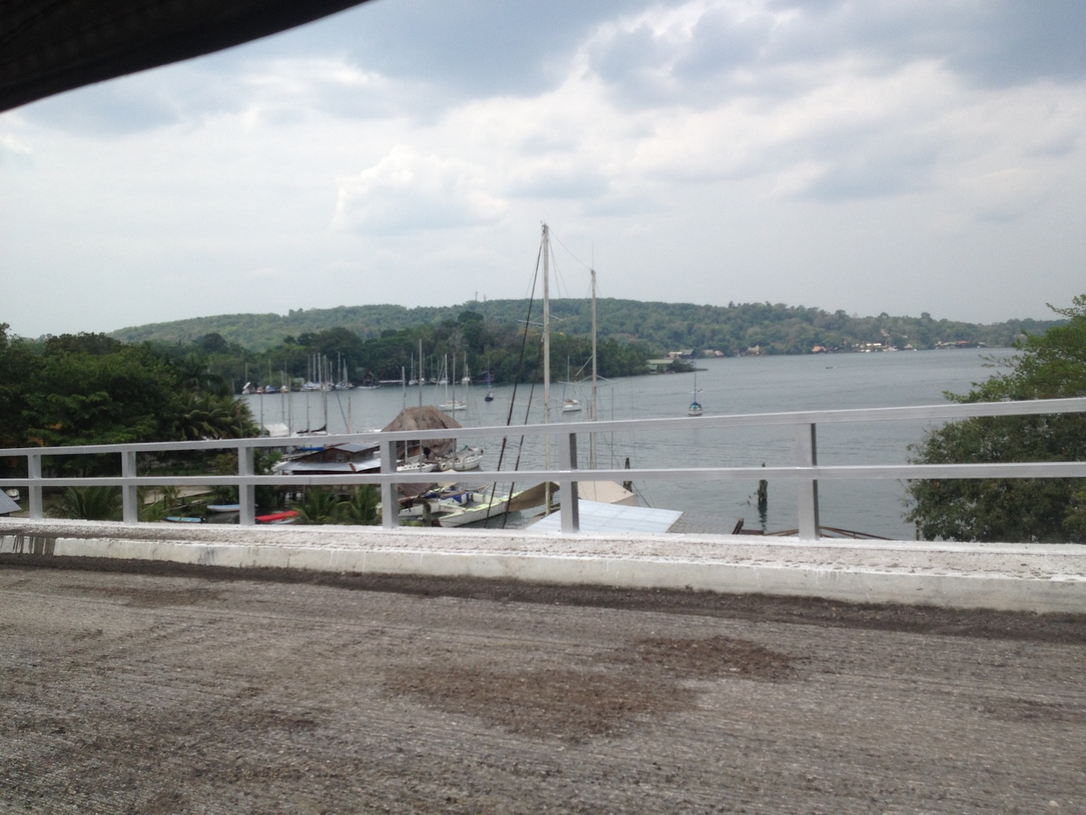
Arriving back in Guatemala Marco, the marina manager, arranged for us to be met at the airport for the 4 hour drive from Guat City to Fronteras; then he brought the launch and took us "home". He'd been looking after Wahoo and on the day of arrival he arranged to have the interior cleaned, even turned on the AC for us. What a welcome!!
Before we knew it we were back in the swing of poolside afternoons, happy hours, potluck dinners and birthday parties. We added a New Orleans twist by bringing Mardi Gras beads to the birthday party and handing out Victoria Inn T-shirts to Marco's girls.

Mario's Marina is a pretty place with palm trees and flowering plants wherever you look. A small pool for hot afternoons, a tienda for necessities and a cantina overlooking the river. Its easy to see why couples who have been cruising for years come here for hurricane season and never leave. Marco makes life easy for the cruisers from refilling the propane tanks to having work done. He keeps his flock happy.

Workmanship in Guatemala is good so while we were stateside the cabin sole was repaired. That turned out so well we decided to have the interior of the Saloon and Galley refinished. Before heading out we wanted to have Wahoo hauled out and her bottom washed, topsides waxed and a seacock that was leaking replaced. 4 - 5 days max. We'd go to Antigua for part of the time and then be ready to provision and go cruising.
Y'all know about the best laid plans, right.
First, our cruising friends, listened in horror as we detailed our 2013/2014 plans to head down the coast to Honduras, a stop at Island Provedencia then on to Panama. Vlad and Attila on Bettie del Mar had done this last year and we'd seen their blog. It all looked so beautiful. In 2014, we planned to continue east eventually getting to the ABC Islands and finally Trinidad - Tobago and do the lesser Antilles counter-clockwise. Here's where knowing your geography comes in handy. What's after Panama? (answer: Columbia and Venezuela). We'll come to find out you absolutely CANNOT go that way. Between the crime in those countries and the winds and seas in the area NO ONE DOES THIS. There's no harbor hopping. If you were going to do it you would have to do it right after hurricane season, wait for a norther to pass and ride the winds down. But even then its a long slog and the crime is still to be faced. Now does that sound like Dale's kind of sailing? What to do?! What to do?!
 |
| Sandblasting done |
Next, our mind gets made up for us.
Wahoo was hauled out, our Antigua plans were firming up and then...
Murphy stepped in. When the bottom was washed the barrier coat started to fail and pretty soon 1/3 or more of all the bottom paint came off with it. We spent two days agonizing and looking at the pricetag to fix it. Our only option really was to sandblast the bottom, hand sand the gelcoat and apply 2 new barrier coats and 2 top coats. To add insult to injury the freezer went out.
So we shortened our stay in Antigua, planned to mostly stay in Belize this summer and leave the boat in Isla Mujeres ready to get our "easting" off the southern coast of Cuba during our next sailing season. Not a bad plan
- easy for friends & family to come and visit. (hint hint)
 |
| Santa Catalina Arch(17th century). So cloistered nuns could pass from convent to school |
 |
| Ruins Inside the Cathedral |
 |
| Volcanoes Agua and Fuego |
 |
| Capitaines General Palace, now abandoned. |
Let me leave you with a bit from our short stay in Antigua Guatemala (meaning old Guatemala). By 1506 when Columbus died all of the Antilles had been discovered and Spain was eager to colonize the mainland.
Spain took very seriously the pope's gift to them and were eager to bring their religion, economic and social order to this new world.
Unfortunately, they were ill equipped to do so. After spending so many years fighting the Moors, creating a unified country and losing the most industrious of their citizens when they expelled the Jews they had a population that was fervently Christain but exhausted. Their society rewarded the few and had no value for the many. However, unlike England and France they sent the finest of their young men out as Conquistadors to build church, found monasteries, build schools and provide for the welfare of the natives. (of course, that's not exactly how it turned out). But in 1523 one of those young Conquistadores, Pedro de Alvarado, came to northern Guatemala and defeated the Mayan Empire in the highlands. He was named Governor of lands that stretched from Chiapas, the southern state of Mexico to present day Costa Rica, including today's El Salvador, Honduras and Belize. He founded a capital, Ciudad do los Caballeros de Santiago, and moved it twice before finally settling on the present spot in a lush valley. It became the capital city of the Kingdom of Guatemala for over 200 years, 1543 - 1773. Fine buildings were built and embellished, a cathedral and over 13 other churches and monasteries were established because as the Spanish went through the country they colonized by building a church and installing a religious order and school. Each order had its headquarters in the capital. The University of San Carlos, the first university in Central America was built there in 1676. Located between Peru and Mexico the city prospered and many of the original Conquistatores' families became merchants and officials.
 |
| Detail from the university entrance |
 |
| our hotel |
Ciudad do los Caballeros de Santiago was situated in a fertile valley between 3 volcanoes. It had a wonderful year round climate, fertile lands and plenty of clean fresh water coming from the rivers in the mountains. However, it also had earthquakes. After the 1773 earthquake the government said "enough already" and ordered everyone out to a new capital, first named Nuevo Guatemala eventually becoming Guatemala City. Not everyone left of course and even though the government took everything - doors, windows, statues, furniture many of the buildings still stood. Years passed and the people of this small town did what people always do they rebuilt their lives and their community.
Eventually they stopped calling it Santiago and called it Antigua Guatemala, old Guatemala. In the 1960's they started looking around and realized they had a beautiful town even if lots of it was filled with rubble from the earthquake. Little by little they improved what they could. In 1979 the town became a Unesco World Heritage Site. Early in the 21st century tourism came to Antigua Guatemala. Now, its a picture book of cobblestone streets, flowering gardens and old world architecture. The town square is once again the heart of the city, many of the fountains are restored and homes with lovely courtyard gardens have been turned into restaurants and small hotels.
 |
| ruins at Santo Domingo Monastery |
 |
| Walkway into the Hotel Casa Santo Domingo |
The Dominican Monastery is slowly being reclaimed and has a 5 star hotel, restaurant and first class museum, but still much of it is still in ruins.
 |
| Gardens and rooms |
In the Cathedral de San José on one side of the square
the entrance transept has been reclaimed as a parish church. The rest of the massive church and rectory shows all the signs of the 1773 earthquake.
 |
| Cathedral de San José |
 |
| Inside no roof, ruins |
Lonely planet says Antigua looks like Guatemala if the Swiss came and ran it for a few years.
We loved it, and the welcome relief of being away from the problems facing us.
 |
| and wine! |
 |
| Always time for chocolate |


 Ranguana Caye is beautiful. There are 3 tiny cabins that share showers and bathrooms looking out toward the reef. Southeast and Southwest of the island is a coral reef that makes the anchorage more protected than you'd expect from its 2 acre size. The island is home to a nesting colony of Sooty Turns plus we saw Magnificent Frigates, Brown Pelicans and even our old friend the Laughing gulls. Anyone wanting to get away from it all - here's the place!


 This area between Laughing Bird Cay to the West and the Silk Cays to the East are the only predictable area in the world where whale sharks are known to gather each Spring. In 2003 the Global Conservation Fund partnered with Friends of Nature to purchase Little Water Caye. So now the whole area from Laughing Bird Cay to the Silk Cays including Gladden Spit is a Marine Preserve and World Heritage Site. Roy thinks he spotted two smaller whale sharks (the largest fish on the earth) put I didn't see any. More time would have been better but we were very worried and felt it best to leave before the weather changed. We have our waypoints and track (see below) so we can return with confidence.


